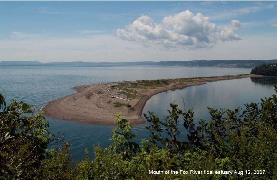
“The Parrsboro Shore” is variously defined as the shore from Portapique, or from Parrsboro west around Cape Chignecto up to Apple River. It is the area encompassed by the recently declared The Cliffs of Fundy Geopark.
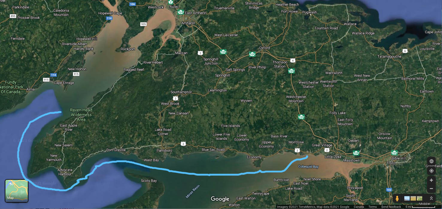
Click on image for larger version. Click here to go to area in Google Maps.
From Wikipedia (Mar 2, 2021):
“The Parrsboro Shore is an area of Cumberland County, Nova Scotia consisting of the shoreline communities west of the town of Parrsboro. The Parrsboro Shore is generally defined as stretching along the Bay of Fundy from the town of Parrsboro westward around Cape Chignecto as far as Apple River. It includes the communities of Diligent River, Fox River, Port Greville, Ward’s Brook, Fraserville, Spencer’s Island, Advocate, the ghost town of Eatonville. Linked by Nova Scotia’s Route 209, the communities form part of the Fundy Shore Ecotour.
“The area is named because the communities form a hinterland for the town of Parrsboro. The Parrsboro Shore was once a major lumbering and shipbuilding centre producing 400 vessels. The area’s history is preserved at the Age of Sail Heritage Centre in Port Greville and at the Parrsboro Shore Historical Society at Ottawa House in Parrsboro.”
From Bay of Fundy Tourism:
“The Cliffs of Fundy Geopark spans 165 km of scenic shoreline from the Portaupique River to Apple River, an area known as the Parrsboro Shore. It boasts over 40 Geosites – stunning examples of earth’s history like Wasson Bluff fossils and minerals, Cape d’Or basalt, the Five Islands fault, and more. The area is an aspiring UNESCO Global Geopark, a designation awarded to an area of international geological significance. Interspersed with impressive geology shaped by the Bay of Fundy tides are historical sites, cultural sites, and a vibrant arts and food scene.”