| Also view subpages: |
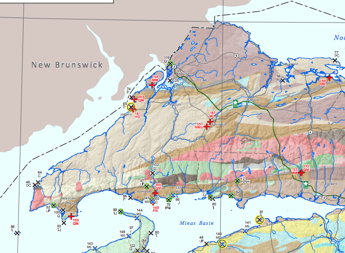
Screen capture of a portion of the Geoheritage Sites of Nova Scotia Map
The Geoheritage Sites of Nova Scotia Compiled b y J.H.Calder & J.C.Poole (2017) is particularly relevant to the topic of this website. View the related Geoheritage Resources page.
Crown Land Information Management Centre (Nova Scotia);
Link brings up an index sheet, select a rectangle/no and it brings up a pdf of a map.
Example Index Sheet # 41 Cumberland County includes Eatonville area, shows land grants… Numbers in circles can be used via Crown Land Record Office to more data (at cost).
To view large versions of Map 041 on the web, go to this page on our website
Map Gallery on novascotia.ca
PDF Maps of Bedrock Geology, Surficial Geology, Hydrogeology, Geochemistry, Geophysics, Gold Districts, Mineral Rights, Geological Resources Atlas, Aggregate Resources, Mineral Deposits, Environmental Risk, Land Use, Coastal, Geoheritage, Shaded Relief, Provincial Scale.
Also view the interactive Geoscience Atlas
| Faribault-Fletcher GSC Maps of Nova Scotia View pages on this website about use of these maps. 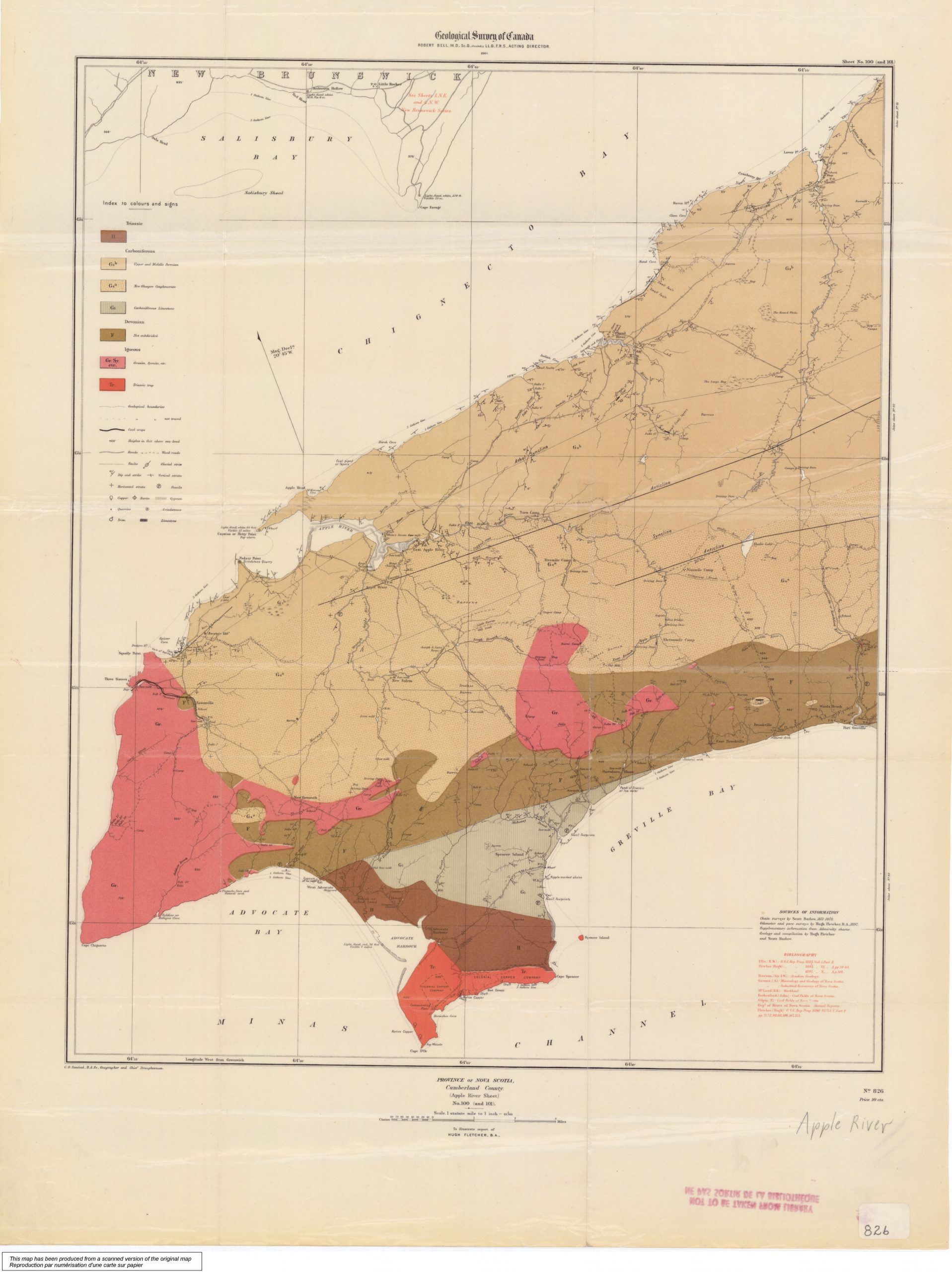 Province of Nova Scotia, Cumberland County, Apple River Sheet, No 100 and 101 From MemoryNS, E. R. Fairbault geological survey maps:
Use this search page to access the maps: https://geoscan.nrcan.gc.ca/starweb/geoscan/servlet.starweb?path=geoscan/geoscan_e.web |
Nova Scotia Landscape Map Viewer
Convenient for viewing Crown lands, Protected Areas, Ecological land Classification and a lot more. This is a key tool for keeping track of forest management history, extent etc. See Codes. Some of the codes found in a Photo Interpretation Specifications.
View Help Page for the Provincial Landscape Viewer. Also ELC – Ecological Land Classification for some of the codes; another page with codes including tree species: Forest Inventory – Current Forest Data (Web Version- 2016)
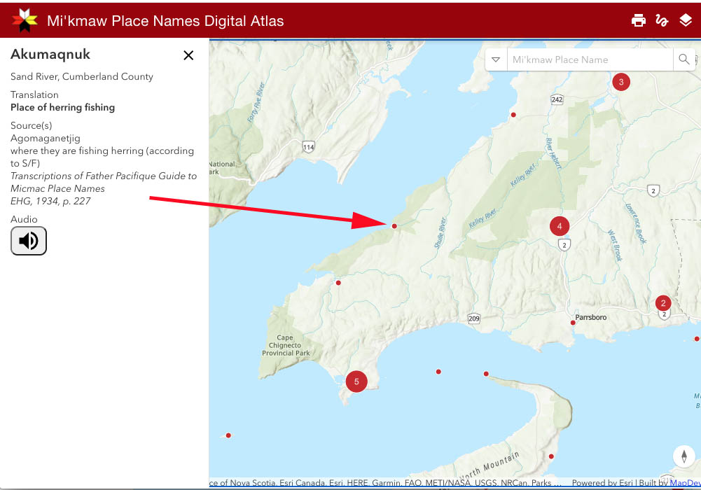
Ta’n Weji-sqalia’tiek Mi’kmaw Place Names
“In 2010, Ta’n Weji-sqalia’tiek Mi’kmaw Place Names Digital Atlas and Website Project (formerly Pjila’si Mi’kma’ki: Mi’kmaw Place Names Digital Atlas and Website Project) was launched to document approximately 13,000 years of Mi’kmaw presence within Mi’kma’ki, the place of the Mi’kmaq, and to raise public awareness of this ancient history…To date, the research team has recorded approximately 1,500 place names collected through interviews with Mi’kmaw Elders and other knowledge holders…”