
Click on image for larger version
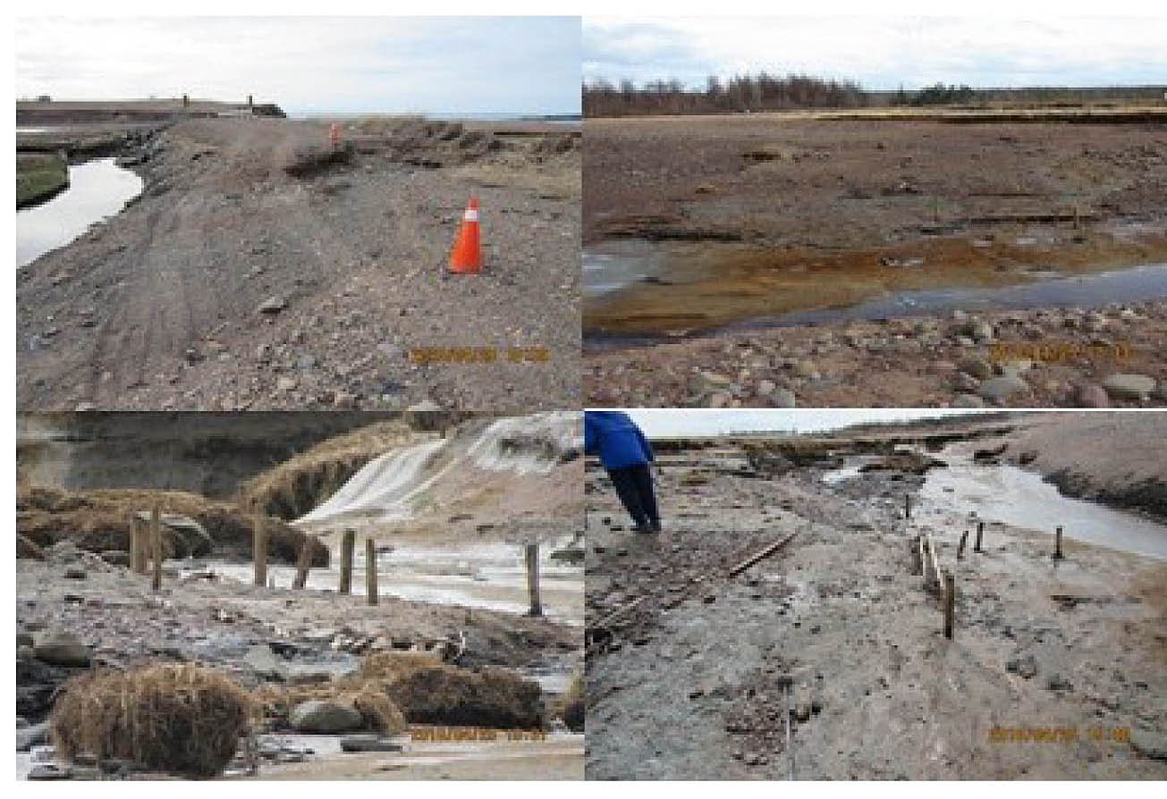
By early January tidal action had exposed more of the wooden brush structure. On the south side of the new stream bed the migration of the beach sediments had buried major portions of the pre-2017 stream bed. On a dropping “Spring” tide a large volume of water can be seen flowing out of the area of the hay marsh through the gap in the dyke. It passes over the area of the man- made brush structure at a high velocity and erodes the poles out of the clay layers. The highest velocity may occur for + 2 hours on either side of the predicted high tide time.
Click on image for larger version
In April “Spring” tides overtopped sections of the dyke adjacent to the bridge. A further 40-50 centimeters of the vertical posts noted in 2017 had been exposed. On the east side of the structure erosion had removed an equivalent thickness of the mats of horizontal poles, brush and clay sods exposing the base of the structure.
In June a grid was laid out over the area of the wooden structure to tie in the wooden elements exposed to date. It is also used to coordinate the location of the images in the digital record. The horizontal poles, and layers of brush and clay sods noted in 2017adjacent to the stream bed have eroded away. These elements made up the base of the structure and several additional layers are present above the base. The top of the newly exposed wooden elements is 1.6 meters higher than the base, with an additional 1.1 to 1.7 meters of hay marsh mud overlain by salt marsh mats (interbedded intertidal mud and sand and organic mats).
Continue to 2019 Observations. (Drafting….)
or Go back to First Page